TOGAN
Multi-Rotor U️AS for Tactical Surveillance and Reconnaissance

TOGAN is a national autonomous multi-rotor reconnaissance UAS solution engineered for general-purpose reconnaissance and surveillance missions with indigenous mission planning software, autonomous intelligence, and operational capabilities.
It can be controlled autonomously or via remote control, and be deployed and operated by a single personnel.
TOGAN® can be used effectively in tactical reconnaissance and surveillance missions, with its abilities to track fixed and moving targetsand to automatically switch mission supported by indigenous and real-time image processing and deep learning algorithms.
The system is capable of both optical and physical target tracking with up to 30× zoom through advanced electro-optical and infrared camera systems.
The system is comprised of "Micro UAV Platform" and "Ground Control Station" components.
TOGAN employs advanced image processing capabilities, enabling the detection and classification of threats that are difficult to spot with human eye.
The CRPA antenna integrated into TOGAN enhances resilience against GPS jamming, ensuring reliable navigation and mission continuity in contested environments. Thanks to KERKES technology, TOGAN can operate autonomously without GPS signals, maintaining precise mission execution even in GNSS-denied areas.

Capabilities
- Combat-Proven
- GNSS-Denied Operational Capability
- Vertical Take-Off and Landing
- Rapid Deployment (Less than 1 minute)
- Day and Night Mission Capability
- Low Radar Cross-Section Platform Design
- 30× Optical Zoom Capability
- Moving Object Detection and Target Tracking
- Target Coordinate Identification and Sharing
- Operable by single personnel
- Mission Abort and Autonomous
- Return-to-Home Functions
- Advanced Image Stabilization
- Precision Landing Sensor
- Interoperability with KARGU Platform
- Artillery Fire Adjustment through Forward Observation
- In-Flight Autonomous Mission Handover
- Take-Off and Landing from Land Vehicles
- Fast Recharge Capability
- High-Resolution Photo Capture
- Vision-Assisted Precision Autonomous Landing
- Operability with TOGAN NEST System/TOGAN NEST is Automated Drone Hangar, Designed for Rugged, Reliability and 24/7 Operation
- Image and Data Transfer over LTE
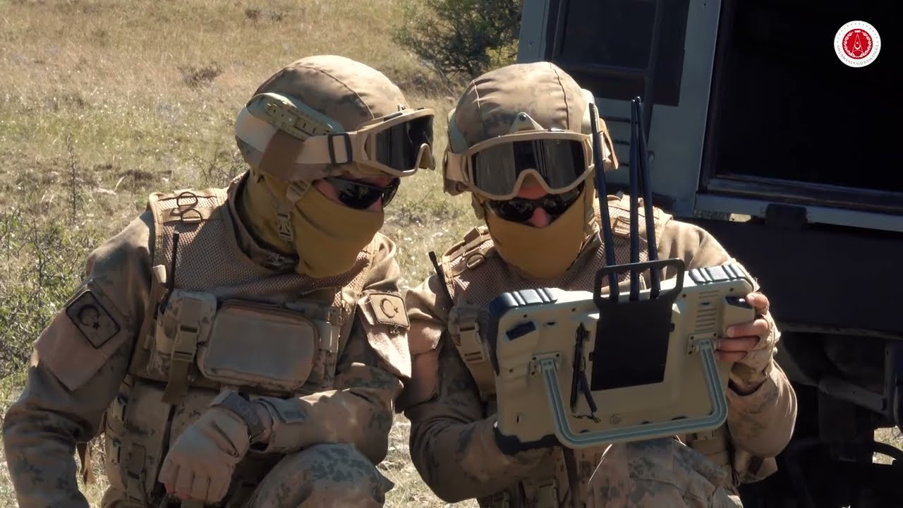
Ground Control Unit
| Operation Type | Mobile |
| Display | Rugged high-precision touchscreen |
| Sunlight Readability | Available |
| Military Environmental Qualification | MIL-STD-810G |
| Water and Dust Resistance | Available |
| Operating Time | 2 hours |
| Operating Temperature | -20°C to +50°C (-4°F to +122°F) |
| Antenna Type | Internal or External Antenna |
| Interfaces | USB-ETHERNET-HDMI |
| Harness Mount and Sunshade | Available |


45 Minute Endurance
10 Km Range
Day / Night Vision Payload
3-Axis Stabilized Imaging System (30× Zoom)
Dimensions
(Unfolded, propellers excluded)
711x711×410 mm (L×W×H)
Dimensions
(Folded, propellers included)
500×450×410 mm (L×W×H)
Faydalı Yük
3-Eksen Stabilize Görüntüleme Sistemi
(30x EO + IR)
Max. Take-off Weight
(Including Payload)
7 kg
Flight Endurance
(Including Payload)
45 min
Range
10 km (with external antenna)
6.5 km (with onboard Ground Control Station antenna)
Imaging Systems
EO/IR Kamera
30x Optical Zoom
Max. Flight Altitude
3000 m (MSL)
Cruise Speed
20 m/s
Wind Resistance
10 m/s
Options
| Opsiyonel CRPA | Opsiyonel KERKES | |
| Boyutlar (Kollar açık, pervaneler hariç) | 711x711×490 mm (U×G×Y) | 711x711×490 mm (U×G×Y) |
| Katlanmış (Pervaneler dâhil) | 500×450×490 mm (U×G×Y) | 500×450×490 mm (U×G×Y) |
| Kalkış Ağırlığı (Faydalı Yük dâhil) | 7.6 kg | 7.6 kg |
| Uçuş süresi (Faydalı Yük dâhil) | 35 dk | 30 dk |


Other Areas of Activities
While prioritizing Türkiye’s defense industry requirements, we diversify our technology-based operations to address the needs of both the public and private sectors, delivering innovative solutions across a broad spectrum.


